
Amazing Road Trips California Key Takeaways
California offers some of the most diverse and jaw-dropping drives in the world, from the rugged Pacific coastline to the towering Sierra Nevada.
- Amazing Road Trips California include everything from the famous Highway 1 to lesser-known gems like the Avenue of the Giants and Tioga Road.
- Each route offers distinct highlights: coastal cliffs, redwood forests, desert dunes, or alpine lakes — so there’s a perfect drive for every season and traveler type.
- Plan ahead for weather, road closures, and lodging — many of these routes are seasonal, especially the high-altitude mountain passes.
Table of Contents
- What Makes These the Best Road Trips in California
- How to Use This California Travel Guide
- Route 1: Pacific Coast Highway — Big Sur to Monterey
- Highlights
- Pro Tip
- Call to Adventure
- Route 2: Highway 395 — Eastern Sierra Scenic Byway
- Highlights
- Pro Tip
- Call to Adventure
- Route 3: Avenue of the Giants — Through the Redwoods
- Highlights
- Pro Tip
- Call to Adventure
- Route 4: Tioga Road — Yosemite’s High Country
- Highlights
- Pro Tip
- Call to Adventure
- Route 5: Highway 1 — San Luis Obispo to Santa Barbara
- Highlights
- Pro Tip
- Call to Adventure
- Route 6: Death Valley — Badwater Road to Artist’s Drive
- Highlights
- Pro Tip
- Call to Adventure
- Route 7: The 17-Mile Drive — Pebble Beach’s Coastal Loop
- Highlights
- Pro Tip
- Call to Adventure
- Route 8: Route 66 — San Bernardino to Barstow
- Highlights
- Pro Tip
- Call to Adventure
- Route 9: Napa Valley — The Silverado Trail
- Highlights
- Pro Tip
- Call to Adventure
- Route 10: Lake Tahoe — The Full Loop
- Highlights
- Pro Tip
- Call to Adventure
- Route 11: The Salton Sea — Anza-Borrego Desert Loop
- Highlights
- Pro Tip
- Call to Adventure
- Route 12: The Lost Coast — Mattole Road
- Highlights
- Pro Tip
- Call to Adventure
- Useful Resources
- What is the best time of year for California road trips ?
- How long does it take to drive the Pacific Coast Highway?
- Are these routes suitable for an RV or campervan?
- Do I need a 4WD for any of these drives?
- Which route is best for a weekend trip?
- Are there any toll roads on these routes?
- Which route has the best views of the ocean?
- Can I bring my dog on these road trips?
- What should I pack for a California road trip?
- Is it safe to drive alone on these routes?
- How much does a California road trip cost?
- Which route is best for fall colors?
- Are there electric vehicle charging stations along these routes?
- Do I need a reservation for any of these routes?
- What is the most underrated road trip in California?
- Can I do all 12 routes in one trip?
- Which route is best for families with kids?
- Are there any dangerous sections on these routes?
- What is the shortest route on this list?
- What is the longest route on this list?
What Makes These the Best Road Trips in California
California is practically built for road tripping. It’s got over 800 miles of coastline, three national parks, a dozen national forests, and a climate that lets you drive from snowy peaks to sunny beaches in a single day. The best road trips in California aren’t just about getting from point A to point B — they’re about the pull-offs, the hidden diners, the sudden ocean views that make you slam the brakes.
Each of the 12 routes below has been chosen for its scenic value, unique stops, and overall drive quality. I’ve ranked them by vibe rather than distance, so you can pick the one that matches your mood — whether that’s a wine-soaked weekend or a rugged desert escape.
How to Use This California Travel Guide
Think of this as your California travel guide to the open road. For each trip, I’ll share the start and end points, the must-see highlights, a practical tip that’ll save you time or money, and a little call to adventure that’ll get you excited to go. You’ll also find a mix of well-known classics and under-the-radar routes that most tourists skip. For a related guide, see 15 Reasons California Is the Best Travel Destination in the.
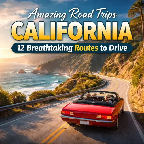
Route 1: Pacific Coast Highway — Big Sur to Monterey
No list of scenic drives California is complete without the Pacific Coast Highway. The stretch from Big Sur to Monterey is the crown jewel — a winding ribbon of asphalt perched between the Santa Lucia Mountains and the Pacific Ocean. Bixby Bridge, McWay Falls, and the sea lions at Point Lobos are all along this route.
Highlights
- Bixby Creek Bridge — one of the most photographed bridges in the world
- Julia Pfeiffer Burns State Park — home to McWay Falls, a waterfall that drops directly onto the beach
- Point Lobos State Natural Reserve — incredible tide pools and sea otter sightings
Pro Tip
Drive north to south for the best ocean views (you’ll be on the cliff side). Fill up your gas tank in Carmel or Morro Bay — stations are scarce between Big Sur and Monterey.
Call to Adventure
Roll down your windows, cue up your favorite driving playlist, and give yourself at least four hours to cover what should be a two-hour drive. The pull-offs will call your name, and you should answer every time.
Route 2: Highway 395 — Eastern Sierra Scenic Byway
For jaw-dropping mountain scenery, nothing beats the Eastern Sierra. Highway 395 runs along the base of the Sierra Nevada range, passing Mono Lake, the Alabama Hills, and the ghost town of Bodie. This is a West Coast road trip that feels like you’ve entered a John Wayne movie.
Highlights
- Mono Lake Tufa State Reserve — otherworldly limestone formations rising from the water
- Alabama Hills — free BLM land where you can camp under the stars with Mount Whitney as your backdrop
- Bodie State Historic Park — a perfectly preserved ghost town
Pro Tip
Stop at the Whoa Nellie Deli inside the Tioga Gas Mart in Lee Vining. It sounds like a gas station — and it is — but their wild buffalo meatloaf is legendary.
Call to Adventure
Pack a camera and a sense of wonder. This is the kind of drive where you’ll pull over every 15 minutes because the light just hit the mountains differently.
Route 3: Avenue of the Giants — Through the Redwoods
If you want to feel tiny in the most humbling way, drive the Avenue of the Giants. This 31-mile stretch runs through Humboldt Redwoods State Park, where the tallest trees on Earth line both sides of the road. It’s one of the most peaceful California road trips you can take.
Highlights
- Founders Grove — an easy 0.5-mile loop through old-growth redwoods
- Driving Through a Tree — you can pay a few dollars to drive your car through a fallen redwood at Shrine Drive Thru Tree
- Fern Canyon — a short detour to a canyon covered in ferns (you’ll recognize it from Jurassic Park 2)
Pro Tip
Go during the week in spring or fall to avoid crowds. The Avenue is a slow, winding road — don’t rush it. Give yourself at least two hours for the main drive, more if you want to hike.
Call to Adventure
Turn off your air conditioning and roll down the windows. Smell the damp earth and redwood bark. This is what California felt like before anyone paved a road.
Route 4: Tioga Road — Yosemite’s High Country
Tioga Road (Highway 120 through Yosemite) is only open from late May to October, but when it’s open, it’s pure magic. This high-altitude route crosses Tioga Pass at 9,943 feet and offers views of alpine meadows, granite domes, and crystal-clear lakes. It’s a must-do for any best road trips in California list.
Highlights
- Olmsted Point — a jaw-dropping view of Half Dome’s backside
- Tenaya Lake — perfect for a quick swim or picnic
- Tuolumne Meadows — vast subalpine meadows with wildflowers in July
Pro Tip
Check the NPS website for road conditions before you go. Even in summer, snow can close the pass unexpectedly. Also, fill up your gas tank in Groveland or Lee Vining — there’s no gas inside the park on Tioga Road.
Call to Adventure
Pack a lunch, a light jacket (it’s cold at 10,000 feet even in July), and a sense of awe. This drive will remind you why national parks exist.
Route 5: Highway 1 — San Luis Obispo to Santa Barbara
This stretch of Highway 1 is often overlooked in favor of Big Sur, but it’s just as beautiful and far less crowded. The road hugs the coast past Morro Bay, Pismo Beach, and the Danish-inspired town of Solvang. It’s a relaxed West Coast road trip with a lot of charm.
Highlights
- Hearst Castle — William Randolph Hearst’s opulent hilltop estate in San Simeon
- Morro Rock — a volcanic plug that rises 576 feet out of the ocean
- Solvang — a quaint Danish village with windmills and bakeries
Pro Tip
Take the 101 instead of the 1 between Gaviota and Santa Barbara unless you have extra time. The 1 is slow and winding, but beautiful. If you’re short on time, the 101 will get you to Santa Barbara faster.
Call to Adventure
Start your morning with a walk on Pismo Beach, then drive north with the windows down. End your day with a glass of wine in the Santa Ynez Valley. That’s a day well spent.
Route 6: Death Valley — Badwater Road to Artist’s Drive
Death Valley is one of the most extreme landscapes on Earth, and driving through it is an experience you’ll never forget. Badwater Road takes you to the lowest point in North America (282 feet below sea level), while Artist’s Drive is a one-way loop through rainbow-colored rock formations. It’s a unique California road trip for those who love the surreal. For a related guide, see 20 Best California Places to Visit for an Unforgettable Trip.
Highlights
- Badwater Basin — walk out onto the salt flats
- Artist’s Palette — a natural canvas of red, orange, and purple hills
- Zabriskie Point — a classic sunrise or sunset spot
Pro Tip
Visit between November and March. Summer temperatures can exceed 120°F, which is dangerous for both you and your car. Bring at least one gallon of water per person, even for a short drive.
Call to Adventure
Stand at Badwater Basin and look up at the mountains. You’re standing at the lowest point in the Western Hemisphere. It’s humbling, hot, and absolutely unforgettable.
Route 7: The 17-Mile Drive — Pebble Beach’s Coastal Loop
It costs $11.25 to enter the 17-Mile Drive, but it’s worth every penny. This private road winds through the Monterey Peninsula, past billion-dollar mansions, world-famous golf courses, and some of the most dramatic coastal scenery in California. It’s a short but stunning scenic drive California that’s perfect for a half-day outing.
Highlights
- The Lone Cypress — the iconic tree perched on a rock that’s been photographed a million times
- Spanish Bay — a beautiful beach for a walk
- Pebble Beach Golf Links — you can watch golfers play one of the most famous courses in the world
Pro Tip
Enter through the Pacific Grove gate and exit through the Carmel gate. This way you’ll get the best views driving along the coast. Also, bring binoculars for whale watching in winter and spring.
Call to Adventure
This is a drive to take slowly — roll down the windows, breathe the salty air, and pretend you’re a millionaire for an hour.
Route 8: Route 66 — San Bernardino to Barstow
You can’t talk about Amazing Road Trips California without mentioning the Mother Road. The California segment of Route 66 runs from San Bernardino to Barstow through the Mojave Desert. It’s dusty, kitschy, and full of roadside nostalgia. Expect vintage motels, greasy spoon diners, and the occasional ghost town.
Highlights
- The Wigwam Motel — sleep in a concrete teepee in Rialto
- Calico Ghost Town — a restored silver mining town with a Wild West vibe
- Daggett — a tiny town with an old gas station that’s a photo op
Pro Tip
This route is best done in spring or fall. Summer in the Mojave is brutal, and there’s not much air conditioning in vintage motels. Also, download offline maps — cell service is spotty.
Call to Adventure
Channel your inner Steinbeck. This is the road of American dreams, dust bowls, and the long, lonesome highway. Embrace the kitsch and the history.
Route 9: Napa Valley — The Silverado Trail
For a road trip that pairs well with a glass of Cabernet, the Silverado Trail through Napa Valley is perfect. This less-crowded alternative to Highway 29 winds through vineyards, past world-class wineries, and offers views that are as beautiful as the wine is delicious. It’s a sophisticated California road trip for wine lovers.
Highlights
- Castello di Amorosa — a 13th-century-style Tuscan castle with a winery inside
- Sterling Vineyards — take an aerial tram up to the tasting room
- Robert Mondavi Winery — a classic Napa experience with a great tour
Pro Tip
Designate a driver or book a tour company. The wine flows freely in Napa, and the roads are winding. Also, make reservations for tastings — many wineries require them post-pandemic.
Call to Adventure
Slow down, sip, and savor. This is a road trip for the senses: the smell of oak barrels, the taste of a perfect vintage, the sight of endless rows of vines stretching toward the Mayacamas Mountains.
Route 10: Lake Tahoe — The Full Loop
The 72-mile drive around Lake Tahoe is one of the most beautiful lake loops in the world. The road hugs the shore, passing state parks, beaches, and alpine viewpoints. In winter, the mountains are dusted with snow; in summer, the lake is impossibly blue. This is a West Coast road trip that works in every season.
Highlights
- Emerald Bay State Park — home to Vikingsholm, a Scandinavian-inspired mansion
- Sand Harbor — crystal-clear water and sandy beaches on the Nevada side
- Mount Rose Highway (431) — a scenic alternate route with panoramic views
Pro Tip
Drive the loop counterclockwise to stay on the lakeside lane for most of the trip. If you’re doing it in winter, check chain requirements — snow can fall heavily at higher elevations.
Call to Adventure
Pack a picnic, a good camera, and a swimsuit. You’ll want to stop at every vista point, and some of those beaches are perfect for a quick dip — even if the water is bracingly cold.
Route 11: The Salton Sea — Anza-Borrego Desert Loop
If you’re into weird, offbeat attractions, this loop is for you. Start at the Salton Sea, a man-made lake turned environmental disaster turned art destination, then head into Anza-Borrego Desert State Park for wildflowers (in spring) and bighorn sheep. It’s a quirky California road trip that’s full of surprises.
Highlights
- Salvation Mountain — a colorful, folk-art mountain covered in Bible verses
- East Jesus — an eccentric outdoor art installation
- Galleta Meadows — metal sculptures of prehistoric animals scattered across the desert
Pro Tip
Bring plenty of water and snacks. Services are sparse in this area. Also, the smell at the Salton Sea can be strong in summer — visit in winter or early spring for the best experience.
Call to Adventure
Embrace the weirdness. This isn’t a polished, postcard-perfect California. It’s raw, strange, and unforgettable. You’ll leave with stories you can’t make up.
Route 12: The Lost Coast — Mattole Road
The Lost Coast is California’s most remote stretch of coastline, where the mountains meet the sea so steeply that Highway 1 was rerouted inland. Mattole Road winds through old-growth forests, past black sand beaches, and along cliffs that feel like the edge of the world. It’s the ultimate scenic drive California for true adventurers.
Highlights
- Black Sands Beach — a dramatic, wild beach at the foot of the King Range
- Ferndale — a Victorian-era town with ornate architecture
- Petrolia — a tiny town with the smallest newspaper in California
Pro Tip
Mattole Road is mostly unpaved and can be rough. A high-clearance vehicle is recommended, and definitely not a sedan. Also, gas stations are very few — fill up in Ferndale or Garberville before you go.
Call to Adventure
This is the California that most tourists never see — wild, raw, and achingly beautiful. Drive slowly, hike a few miles on the Lost Coast Trail, and feel what it’s like to be truly off the beaten path.
Useful Resources
- National Park Service — California Parks — official info on road conditions, permits, and closures for national parks and monuments.
- Caltrans QuickMap — real-time traffic, road closures, and chain requirements for California highways.
Frequently Asked Questions About Amazing Road Trips California
What is the best time of year for California road trips ?
Spring (March to May) and fall (September to November) offer the best weather, fewer crowds, and stunning scenery. Summer is great for coastal drives and high-altitude routes like Tioga Road, but can be crowded in popular areas. Winter works for desert and wine country routes, but mountain passes may be closed.
How long does it take to drive the Pacific Coast Highway?
The full drive from San Francisco to Los Angeles on Highway 1 takes about 10 hours without stops, but you need at least 3 days to enjoy the sights. The most scenic section — Big Sur to Monterey — can be done in a half-day if you’re short on time.
Are these routes suitable for an RV or campervan?
Most routes are RV-friendly, but the Pacific Coast Highway (especially through Big Sur) has narrow sections and tight turns. The Lost Coast’s Mattole Road is not recommended for large RVs. Always check length and weight restrictions before you go.
Do I need a 4WD for any of these drives?
Most routes are paved and accessible with a standard car. However, the Lost Coast (Mattole Road) and some desert paths in Anza-Borrego may require high clearance and 4WD, especially after rain or snow.
Which route is best for a weekend trip?
The 17-Mile Drive combined with Monterey and Carmel is perfect for a weekend. The Silverado Trail in Napa Valley is another great option for a relaxing weekend with wine tasting.
Are there any toll roads on these routes?
The 17-Mile Drive has an entrance fee of $11.25 per vehicle (cash or card). All other routes are free except for standard state park entry fees at places like Julia Pfeiffer Burns State Park and Humboldt Redwoods State Park.
Which route has the best views of the ocean?
The Pacific Coast Highway from Big Sur to Monterey offers the most dramatic ocean views, with cliffs dropping straight into the sea. The 17-Mile Drive and Highway 1 from San Luis Obispo to Santa Barbara are also excellent for coastal scenery.
Can I bring my dog on these road trips?
Yes, but keep your dog on a leash in state and national parks. Many beaches and trails do not allow dogs, so check specific park rules before you go. Always bring water for your pup, especially in hot weather.
What should I pack for a California road trip?
Pack layers — California weather can change quickly, especially along the coast and in the mountains. Bring sunscreen, sunglasses, a reusable water bottle, snacks, a phone charger, a paper map (cell service can be spotty), and a camera.
Is it safe to drive alone on these routes?
Yes, most routes are safe and well-traveled. Use common sense: avoid driving at night on winding or remote roads, keep your gas tank full, let someone know your route, and carry a spare tire. The Lost Coast and Death Valley require extra caution due to isolation and extreme temperatures.
How much does a California road trip cost?
Costs vary widely. Gasoline is the biggest variable; budget around $50–$100 for a full tank depending on your vehicle and fuel prices. Accommodations range from $30/night for camping to $300+ for hotels. Park entry fees are $10–$35 per vehicle. Plan to spend $100–$200 per day for a moderate trip.
Which route is best for fall colors?
The Eastern Sierra (Highway 395) offers spectacular fall colors in October, especially around Bishop Creek Canyon and June Lake Loop. The aspens turn gold and orange against a backdrop of snow-capped peaks.
Are there electric vehicle charging stations along these routes?
Yes, but coverage varies. The Pacific Coast Highway, Napa Valley, and Lake Tahoe have good charging networks. The Lost Coast and Death Valley have very few chargers. Use apps like PlugShare to plan ahead, and always carry a backup plan.
Do I need a reservation for any of these routes?
Yosemite National Park requires a reservation for vehicle entry during peak summer months (May through September) — check the NPS website. Some wineries in Napa also require reservations for tastings. Most other routes are open without reservations.
What is the most underrated road trip in California?
The Lost Coast is incredibly underrated. It’s remote, wild, and offers a raw coastal experience that’s very different from the more touristy parts of Highway 1. The Salton Sea loop is another hidden gem for fans of quirky, offbeat attractions.
Can I do all 12 routes in one trip?
That would take several weeks and require a lot of driving — not recommended unless you have unlimited time and energy. A better approach is to pick 2–3 routes based on your interests and the time of year, then plan a trip around them.
Which route is best for families with kids?
The Avenue of the Giants is great for families — it’s easy, short, and full of giant trees that kids love. Lake Tahoe loop also offers beaches, hiking, and paddleboarding. The 17-Mile Drive is short and has plenty of pull-off spots for little legs.
Are there any dangerous sections on these routes?
The Pacific Coast Highway through Big Sur has sharp curves and narrow shoulders, and rockslides can occur. Tioga Road has steep drop-offs with no guardrails. Death Valley in summer is dangerous due to extreme heat. Always check road conditions and drive cautiously.
What is the shortest route on this list?
The 17-Mile Drive is the shortest at about 17 miles (hence the name), but plan to spend 1–2 hours with stops. The Avenue of the Giants is 31 miles and can be done in 2–3 hours with short walks.
What is the longest route on this list?
The full loop around Lake Tahoe is about 72 miles, but if you include side trips like Emerald Bay and Mount Rose, you can easily spend a full day. Highway 395 from Bishop to Bridgeport is roughly 100 miles with plenty of stops.
Ready to hit the road? The Amazing Road Trips California experience is waiting for you. Pick a route, pack your bags, and let the Golden State show you why it’s one of the best places in the world for a scenic drive.

Jin Grey is a Filipino Senior SEO Consultant and AI-First SEO Strategist who helps international brands grow through modern search strategies. She specializes in technical SEO, semantic keyword research, and AI-ready content creation. She is also the owner of JinGrey.com.
As a digital nomad, she loves exploring the world and trying different cuisines during her free time.